Local footpaths around Aston Cantlow
This is an initial list which will be added to expanding further out in the parish:
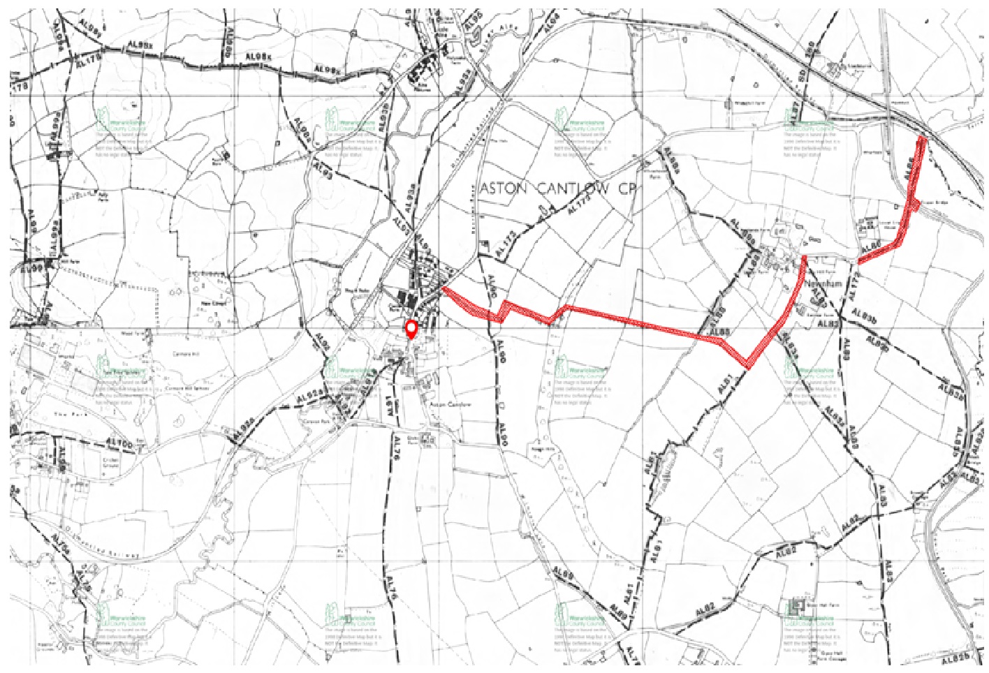
The map at the end of the list can also help to identify the location of these paths
AL72 Bridleway from Wood Lane across the field to the entrance of the woods
AL76 Footpath south on Farm track from Mill Lane almost opposite exit of AL91 to Wood Lane
AL88 Bridleway from by last house on Bearley Road to Newnham over the rough hills
AL88a Footpath Newnham to White house Hill
AL98a Footpath across a field as continuation of AL93 after crossing the B4089 Henley Road between just west of Little Alne.
AL90 Footpath from Suffield’s Homelea Farm to Wilmcote Lane just past the Old Green
AL91 Left of the 2 footpaths from inside St John’s Churchyard entrance across a stream on a bridge then across a field to Mill Lane
Al91a Right of the 2 footpaths from inside St John’s Churchyard entrance past the old school house between 2 fields (known as Millennium Avenue) to Mill Lane exiting by the Severn Trent pumping station and entrance to the Island Meadow Caravan Park
AL92 Footpath through Island Meadow Caravan Park going over the River Alne then across the old railway line and coming out on the B4089 Henley Road between Great Alne and Little Alne.
AL92a Footpath coming off the AL92 to the left meeting then following the old railway line to come out onto a track which goes past an electricity substation then up to the B4089 Henley Road just East of Great Alne
AL93 Footpath from the bottom of Chapel Lane across the old railway line then down to the River Alne. Then across the river on the bridge and up across the field on the other side,
AL93a Footpath from just after where AL93 crosses the old railway line along the top hedge parallel to the river to just before the road bridge over the River Alne
AL93b Footpath starting where AL93 crosses the River Alne following the river and field edge coming out on the B4089 Henley Road in Little Alne
AL98x Footpath that starts on the opposite side of the road to the end of AL93b and heads west towards Shelfield Green
AL173 Footpath from bottom of White House hill to Suffield’s Homelea Farm
Below is a section of the definitive map of rights of way, bridleways and footpath in the immediate vicinity of Aston Cantlow. The full map can be accessed at https://maps.warwickshire.gov.uk/rightsofway/#